
Discover Sydney's best coastal walks beyond Bondi to Coogee, from harbour tracks and wild headlands to quiet beaches and sandstone cliffs.
There is a particular point on almost every Sydney coastal walk when the city seems to loosen its grip.
It may happen after a suburban street gives way to bushland. It may come with the first glimpse of open water through a stand of angophoras, or when the sound of traffic is replaced by waves working against sandstone below. Sydney is often experienced through its famous landmarks, but walking its edges offers another way of understanding the city.
Bondi to Coogee has earned its place in the imagination. It is dramatic, accessible and stitched together by beaches that have become part of Sydney's public identity. But it is not the only coastal walk worth making time for.
Beyond the familiar route lies a city of quieter headlands, harbour beaches, old military sites, bush tracks and long stretches of coastline where the horizon seems considerably further away. Some walks finish beside a café or ferry wharf. Others end at a lighthouse, a weathered cliff or a beach where the only sensible plan is to sit for a while.
These are Sydney's best coastal walks for those willing to look beyond Bondi to Coogee.
Sydney Coastal Walks That Follow the Harbour's Edge
The harbour changes the idea of a coastal walk.
There is less of the relentless Pacific and more interruption. Bays curve away unexpectedly. Small beaches appear beneath suburban streets. Bushland survives between expensive homes and old sandstone walls.
The result is a landscape that feels distinctly Sydney.
Spit Bridge to Manly
The Spit Bridge to Manly Walk is perhaps the strongest alternative to Bondi to Coogee because it offers so much of what makes Sydney distinctive in one journey.
Known officially as the Manly Scenic Walkway, the 10-kilometre route follows Middle and North Harbour from the Spit Bridge to Manly. NSW National Parks suggests allowing between three and a half and four and a half hours, depending on pace and stops.
The walk moves between very different landscapes. Clontarf Beach introduces the harbour at its most leisurely, while Castle Rock and Dobroyd Head feel increasingly removed from the city. Along the way are Aboriginal rock engravings at Grotto Point, bushland sections and small beaches including Reef Beach and Forty Baskets.
The best way to approach this walk is without trying to rush it. Bring water and something to eat. Swim if conditions allow. Stop when the track opens onto a view that seems worth remembering.
By the time Manly appears, the transition feels satisfying. Bushland gives way to harbour houses, then wharves, then the familiar movement of ferries and people along the Corso.
Location: Spit Bridge, Mosman to Manly Wharf
Distance: 10km one way
Suggested time: 3.5 to 4.5 hours
Official link: NSW National Parks – Manly Scenic Walkway
The Harbour Bridge to Spit Bridge Walk
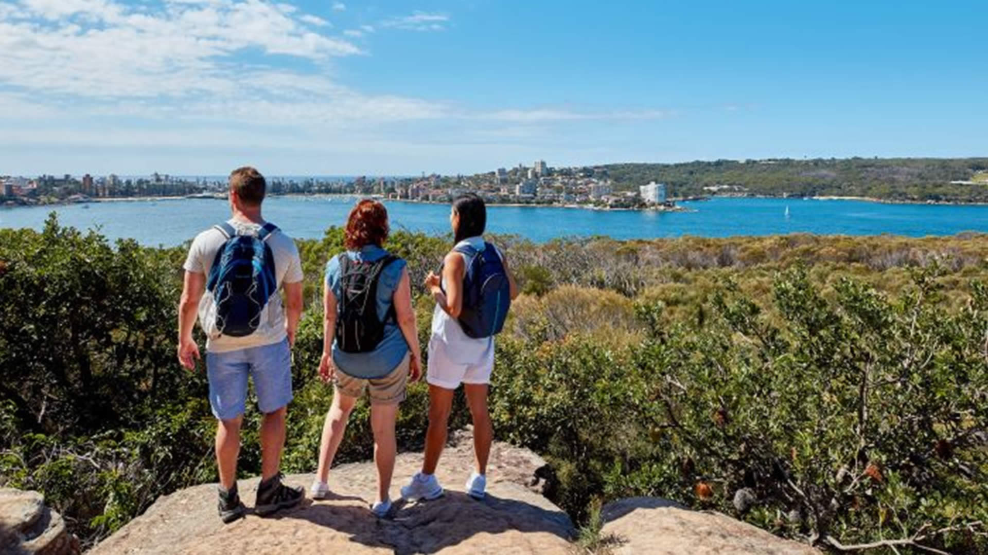
For those who want to see just how much coastline can hide within an urban journey, the Harbour Bridge to Spit Bridge walking track offers a longer and more layered route.
The 16.5-kilometre walk follows Sydney's northern harbour shore and passes historic fortifications, Federation-era neighbourhoods, bushland and harbour beaches. NSW National Parks suggests allowing five to six hours for the full route.
It begins in the shadow of the Harbour Bridge and gradually moves away from the CBD. The route passes Bradleys Head, Chowder Bay, Middle Head and Balmoral before reaching the Spit.
The remarkable thing about this walk is how often the city seems to disappear without ever actually being far away. One section may be defined by grand homes and carefully maintained streets. The next leads through bushland where the harbour is visible only in fragments.
It is also easy to break into shorter sections, making it one of the more flexible Sydney coastal walks for a weekend when six hours feels ambitious.
Location: Sydney Harbour Bridge to Spit Bridge
Distance: 16.5km one way
Suggested time: 5 to 6 hours
Official link: NSW National Parks – Harbour Bridge to Spit Bridge Walking Track
A Coastal Walk Through Sydney's Hidden Harbour Beaches
Hermitage Foreshore Track
The Hermitage Foreshore Track offers a gentler kind of Sydney walking.
The route through Vaucluse follows the harbour edge past beaches, sandstone, old trees and lookouts. It is the sort of walk where progress is regularly interrupted by the temptation to stop.
The track provides views across Sydney Harbour towards Shark Island and the Harbour Bridge, while Nielsen Park offers a natural place to begin, finish or simply pause for longer than planned.
Unlike some longer Sydney coastal walks, the Hermitage Foreshore Track works particularly well for an unhurried afternoon. There is no need to conquer distance. The pleasure comes from following the water as the shoreline folds in and out of view.
Bring swimmers on a warm day. Pack a picnic. Let the walk take the time it takes.
Location: Vaucluse, between Bayview Hill Road and Nielsen Park
Distance and walking time: Varies according to entry and exit points
Official link: NSW Government – Hermitage Foreshore Track
Sydney Coastal Walks Where the Bush Takes Over
One of Sydney's great geographical surprises is how quickly the suburbs can fall away.
Walk long enough along the northern and southern edges of the city and the familiar landscape of roads and terraces begins to give way to heath, sandstone and scrub. These walks require a little more preparation, but they offer a different relationship with the coast.
The Northern Beaches Coast Walk
The Northern Beaches Coast Walk stretches approximately 36 kilometres from Manly to Palm Beach, linking beaches, headlands and coastal lookouts along one of Sydney's longest continuous shoreline journeys. Most people sensibly approach it in sections.
There is no need to complete the entire route to appreciate it. Choose a stretch and give yourself time to notice the changing coastline.
The journey north gradually changes the atmosphere of Sydney. Manly still feels connected to the city, but further along the coast the beaches become more separated by headlands and bushland. The Pacific becomes the constant companion.
For visitors, this is an excellent way to understand the scale of Sydney's Northern Beaches. For locals, it offers a reminder that the coast can still feel expansive even within the metropolitan area.
Location: Manly to Palm Beach
Distance: Approximately 36km in total
Walking time: Best completed in sections
Official link: NSW Government – Northern Beaches Coastal Walk
South Head and Watsons Bay
South Head is a walk for people who enjoy standing at the edge of things.
From Watsons Bay, tracks lead towards dramatic views over Sydney Harbour and the Pacific. The land narrows, the wind becomes more noticeable and the city is suddenly arranged behind you rather than in front.
The area is shaped by military history as well as geography, with historic gun emplacements and the distinctive Hornby Lighthouse adding another layer to the journey. NSW National Parks notes that the South Head Heritage Trail passes through the area's lookouts and historic sites.
Between June and September, the headland can also provide opportunities to watch migrating whales offshore.
This is not a walk to measure in kilometres alone. It is about the meeting point between harbour and ocean, and the way Sydney's landscape suddenly opens at the entrance to Port Jackson.
Location: Watsons Bay and South Head, Vaucluse
Dates: Year-round
Times: Daylight hours recommended
Official link: NSW National Parks – South Head
Sydney Coastal Walks with Wild Headlands and Cliffs
Malabar Headland
Malabar Headland is one of the strongest reminders that Sydney's eastern coastline is not entirely built over.
Between Maroubra and Malabar beaches, the national park protects a rugged landscape of cliffs, sandstone escarpments and remnant bushland. Views stretch north towards Bondi and south towards La Perouse.
The Western Escarpment walking track is a shorter option, running one kilometre one way through native heath and providing coastal views, birdlife and seasonal wildflowers. NSW National Parks suggests allowing 20 to 30 minutes.
For something longer, the Boora Point walking track covers 5.6 kilometres return and reaches spectacular clifftop viewpoints. The track can be affected by closures associated with operations at the ANZAC Rifle Range, so checking current alerts before visiting is essential.
This is a more exposed coastline than Bondi to Coogee. The ocean feels less arranged for visitors. There are fewer distractions, and that is precisely the appeal.
Location: Maroubra to Malabar
Distance: 1km one way for Western Escarpment, 5.6km return for Boora Point
Official link: NSW National Parks – Malabar Headland National Park
The Southern Sydney Coastal Walk Worth the Trip
Cape Baily Track, Kurnell
South of the airport, at the edge of Kamay Botany Bay National Park, the Cape Baily walking track follows sandstone cliffs towards a coastline that feels surprisingly remote from central Sydney.
The walk begins near Cape Solander and can be completed as a four-kilometre one-way journey to Potter Point or as an eight-kilometre return walk. NSW National Parks suggests allowing around three hours for the return journey.
The route passes dramatic sandstone formations and open ocean views before reaching Cape Baily Lighthouse, a distinctive concrete structure built in 1950.
This is a walk that suits Sydney's cooler months particularly well. The exposed track offers little shade, and walkers should carry water, sun protection and suitable footwear. There is also no drinking water along the route.
From May to November, the coastline can provide opportunities to spot migrating humpback whales, while dolphins and seabirds are also part of the wider landscape.
Cape Baily is not a polished promenade. It is a place where the wind, cliffs and distance are part of the experience.
Location: Kamay Botany Bay National Park, Kurnell
Distance: 8km return or 4km one way
Suggested time: Approximately 3 hours return
Official link: NSW National Parks – Cape Baily Walking Track

Shorter Coastal Walks for When Time Is Limited
Not every good walk requires half a day.
Sydney is particularly well suited to shorter coastal journeys because the landscape changes quickly. A half-hour can take you from a car park into bushland. An hour can be enough to reach a headland and return.
Western Escarpment, Maroubra
For a short walk with a strong sense of place, the Western Escarpment track is difficult to overlook.
The one-kilometre route connects South Maroubra Beach with Malabar through bushland that supports the eastern suburbs banksia scrub, one of NSW's critically endangered ecological communities.
The track is not long, but it offers enough contrast to make the journey memorable. Maroubra's surf and suburbia give way to native heath, birdlife and broad views over the coast.
Location: Malabar Headland National Park
Distance: 1km one way
Suggested time: 20 to 30 minutes
Official link: NSW National Parks – Western Escarpment Walking Track
Muru and Yena Tracks, Kurnell
For another shorter escape into coastal landscape, the Muru and Yena tracks form a loop through the Kurnell section of Kamay Botany Bay National Park.
The tracks pass through changing vegetation, including dry eucalypt forest, sandstone heath and heathland dunes. The journey reaches Yena picnic area, positioned on a grassy clifftop above the sandstone coastline.
It is an easy way to experience the southern coastline without committing to the longer Cape Baily route.
Location: Kamay Botany Bay National Park, Kurnell
Distance: Approximately 2.5km loop
Official link: NSW National Parks – Muru and Yena Tracks
What to Know Before Walking Sydney's Coast
The best Sydney coastal walks are accessible precisely because the city and landscape sit so closely together. That proximity can occasionally make preparation seem unnecessary.
It is still worth planning.
Carry water, particularly on exposed tracks. Wear shoes appropriate to uneven sandstone and bush paths. Check weather conditions before leaving home, and pay attention to official track alerts, particularly in national parks where fire danger, weather and operational requirements can affect access.
Some harbour walks are suitable for casual afternoon exploration. Others require several hours and a reasonable level of fitness.
The Manly Scenic Walkway, for example, is graded Grade 3 and includes varied terrain, while the Boora Point track is Grade 4 and has steeper and more challenging sections.
Above all, remember that the coast is not a stage set.
Stay behind barriers and well away from cliff edges. Swim only where conditions are appropriate and, when possible, at patrolled beaches. Let the weather decide the pace rather than trying to force a planned itinerary.
The Coast Beyond the Famous Route
Bondi to Coogee will continue to draw walkers because it offers an extraordinary concentration of beaches and headlands.
But Sydney is much larger than that stretch of coast.
Walk west along the harbour and the ocean becomes quieter. Head north and the coastline begins to feel longer and less contained. Travel south to Kurnell and the sandstone opens towards an older, wilder edge of the city. At Malabar, bushland still holds its ground between suburbia and the sea.
The best Sydney coastal walks are often the ones that leave room for surprise.
A beach you did not know existed. A view reached after a steep set of steps. A lighthouse appearing through coastal heath. The sound of a ferry somewhere below the track.
At the end of the walk, the city is still there. Trains still run. Traffic still gathers at intersections. But for a few hours, Sydney has been reduced to something more elemental: rock, water, wind and the steady movement of one foot in front of the other.